
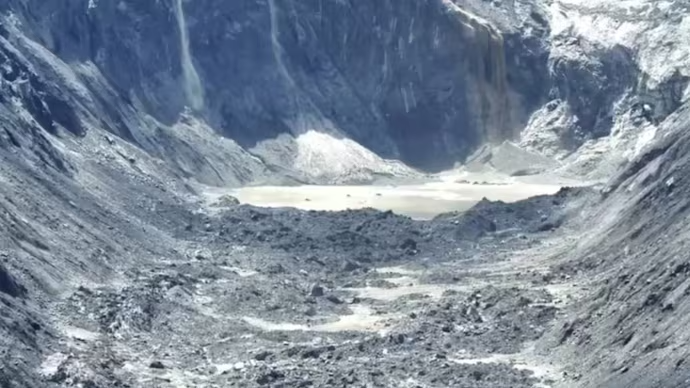
A devastating flash flood along the Nepal-Tibet border has raised fresh concerns about the growing dangers of unstable Himalayan glaciers. China has said that the disaster may have been triggered by the collapse of a high-altitude glacier in Nepal, adding another important piece to the investigation into one of the region’s most destructive recent natural disasters.
The disaster struck mountainous areas close to the Nepal-China border, sending enormous quantities of water, ice, rocks, mud and other debris downstream. Communities located along river valleys were caught with little time to respond, while roads, bridges, buildings and other infrastructure suffered extensive damage.
The latest assessment from Chinese authorities broadly matches preliminary findings from Nepalese officials and a revised analysis by the US Geological Survey. Together, the findings point toward a glacier-related collapse and debris flow rather than an ordinary rainfall-driven flood.
How The Glacier Collapse Triggered Flooding
The sequence appears to have started high in the Himalayas, where a section of glacier and surrounding rock became unstable. When the mass collapsed, it generated an ice-rock avalanche that moved rapidly into the Lhende River system.
The avalanche reportedly created a temporary blockage in the river. Water accumulated behind the natural barrier before the obstruction eventually failed, releasing a powerful surge downstream.
That sudden release transformed the event into a destructive debris-laden flood. Instead of carrying only water, the rushing flow transported enormous amounts of mud, boulders, broken ice and sediment through narrow Himalayan valleys.
The flood then moved into river systems including the Bhotekoshi and Trishuli, allowing the destructive force to travel far beyond the original collapse zone. Satellite imagery and ground observations have helped scientists reconstruct this chain of events.
Why The Himalayan Geography Matters
The Himalayan landscape can make glacier-related disasters particularly dangerous. Steep slopes allow falling ice and rocks to accelerate rapidly, while narrow valleys concentrate enormous amounts of water and debris into relatively small channels.
This means that a collapse occurring several kilometres upstream can become a major emergency for communities much farther downstream. Residents may receive very little warning because the initial event happens in remote, high-altitude terrain.
In this case, the floodwaters moved through interconnected river channels before reaching populated areas. Reports indicated that water levels in the Trishuli River rose dramatically within a very short period, demonstrating how quickly conditions can change during such events.
The geography also complicated rescue operations. Destroyed roads and bridges isolated several communities, while unstable slopes and changing river conditions created additional risks for emergency teams.
Nepal Floods Cause Widespread Destruction
The impact across Nepal has been severe, with hundreds of deaths reported and many more people still missing as rescue and recovery operations continue. The disaster has affected local residents, workers, tourists and pilgrims travelling through the Himalayan region.
The latest figures have changed rapidly as authorities continue identifying victims and searching damaged areas. Reports on August 28 indicated hundreds of deaths across Nepal and Tibet, while thousands of people remained unaccounted for or were awaiting confirmation of their safety.
Several important transportation routes were damaged or destroyed. Bridges were swept away, roads disappeared beneath mud and debris, and some infrastructure near the border was severely affected.
The destruction has also created serious problems for emergency logistics. Helicopters have become crucial for reaching isolated communities, delivering supplies and evacuating people from locations that cannot currently be reached by road.
China And Nepal Share A Dangerous Border
The disaster has highlighted how natural hazards do not respect political boundaries. The affected Himalayan rivers and mountain systems connect areas on both sides of the Nepal-China border.
China reported damage in Tibet, particularly around the Gyirong area, while Nepal experienced severe flooding farther downstream. This geographical connection makes information sharing and coordinated disaster monitoring especially important.
Chinese officials have said their preliminary assessment is consistent with conclusions emerging from Nepal. That convergence is significant because the exact trigger was initially uncertain, with seismic activity briefly considered as a possible explanation.
Further analysis indicated that the seismic signal was associated with the glacier collapse and resulting debris movement rather than being the primary cause of the disaster.
Could Climate Change Be A Factor?
The glacier collapse has also revived concerns about climate change and the changing condition of Himalayan ice. Scientists have repeatedly warned that rising temperatures are contributing to glacier retreat across the Hindu Kush Himalaya region.
That does not mean every glacier collapse can automatically be attributed to climate change. Individual failures can involve several factors, including unstable rock, melting ice, rainfall, snow conditions, gravity and geological weaknesses.
However, a warmer climate can alter the stability of glaciers and mountain slopes. Faster melting can change the way water moves through and beneath ice, while the loss of permanently frozen ground can weaken slopes that previously provided greater stability.
The Hindu Kush Himalaya region has already experienced significant ice loss over recent decades. Scientists therefore expect risks connected with glacial lakes, ice avalanches and sudden floods to remain an important concern in the coming years.
New Lakes Add Another Warning
The danger has not necessarily ended with the first flood. The movement of ice, rock and sediment can block rivers and create temporary lakes, sometimes called barrier lakes.
Such lakes can become dangerous when water continues collecting behind unstable natural dams. If the barrier breaks suddenly, another powerful flood can travel downstream with very little warning.
Authorities have been monitoring newly formed water bodies in the affected Himalayan region because additional flooding remains possible. Satellite imagery has become especially important for tracking water levels and identifying changes in remote locations that are difficult for rescue teams to reach directly.
This secondary threat makes disaster management much more complicated. Rescue workers must not only search for missing people but also remain alert to another possible surge.
Early Warning Systems Face A Tough Test
One of the biggest questions following the disaster concerns whether earlier warnings could have reduced the loss of life. Monitoring Himalayan glaciers is extremely difficult because many unstable areas are located at high elevations and remain inaccessible for much of the year.
Traditional river monitoring systems may also struggle with sudden events that begin far upstream. A glacier collapse can happen rapidly, and the resulting flood can travel through steep valleys before authorities have enough time to issue effective warnings.
Experts have therefore stressed the importance of combining satellite monitoring, ground sensors, river gauges, geological surveys and faster communication systems. Cross-border cooperation could also make warning systems more effective because the source of a disaster may be located in one country while its worst effects occur downstream in another.
What This Disaster Means For Nepal
The latest Nepal flash floods show how quickly a high-altitude natural event can become a national emergency. The disaster was not simply a case of heavy rainfall overwhelming rivers. It involved a complex chain beginning with glacier instability and continuing through an avalanche, temporary river blockage, debris movement and sudden downstream flooding.
For Nepal, the immediate priority remains rescuing survivors, finding missing people and restoring access to isolated communities. The longer-term challenge will involve rebuilding damaged infrastructure while making mountain settlements more resilient to future disasters.
The event also carries a wider message for countries across the Himalayan region. As glaciers continue changing, governments will need better information about unstable slopes, glacial lakes and vulnerable river valleys.
Conclusion
The deadly Nepal flash floods have brought the hidden risks of a changing Himalayan environment into sharp focus. China’s assessment that a high-altitude glacier collapse may have triggered the disaster broadly aligns with emerging scientific and official findings about the event.
The tragedy demonstrates that glacier-related hazards can develop far from populated areas before suddenly affecting communities downstream. Climate change may be increasing the broader vulnerability of Himalayan ice and mountain systems, although individual glacier failures usually involve several interacting causes.
Better monitoring, faster warnings and stronger cooperation between Nepal, China and other Himalayan countries could become increasingly important. The latest disaster is a painful reminder that understanding these changing mountains is no longer only a scientific priority, but also a crucial part of protecting lives.
Read More :-